
Mapping Mumbai's Digital Future
I write often about cities as living systems — messy, adaptive, and stubbornly human. So when the Brihanmumbai Municipal Corporation (BMC) began rolling out a city‑wide 3D mapping project I watched closely. The initiative, reported by the Times of India, aims to create a detailed digital twin of Mumbai to support planning, disaster response, encroachment detection and far more. In this post I’ll unpack what this means practically, the technologies involved, the benefits, and the real constraints the city faces.
What the project is — in plain terms
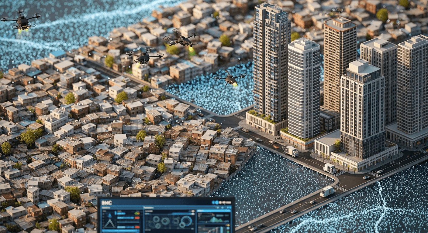
At its heart the BMC’s 3D mapping project builds a high‑resolution, three‑dimensional model of the city — buildings, roads, bridges, drains, open spaces and even informal settlements — and stitches that with street‑level panoramic imagery. The goal is a living digital twin that municipal teams can query, simulate and update over time for more intelligent decision making. The initiative was announced and described by municipal leadership and cited in the news coverage from the Times of India.
Project goals
- Enable precise urban planning and infrastructure design
- Improve disaster preparedness and response (flooding, fires, evacuations)
- Provide tools for encroachment detection and property assessment
- Support coordinated decision‑making across departments with a single geospatial source of truth
The core technologies (simple explanations)
- LiDAR (Light Detection and Ranging): lasers mounted on aircraft or vehicles emit pulses and measure return times to create dense 3D point clouds. LiDAR gives accurate elevation and structural form, even under tree canopies.
- Photogrammetry: overlapping aerial or drone photos are processed to reconstruct surfaces and textures. It produces visually rich 3D meshes and orthophotos.
- GIS (Geographic Information Systems): the framework that stores, analyses and layers spatial data — parcels, utilities, land use, road networks — making the 3D model actionable for planners and engineers.
Together these produce a geospatial stack: point clouds + textured meshes + attribute databases = a usable digital twin.
Benefits (practical examples)
- Faster, evidence‑based approvals and design comparisons for roads, bridges and public works
- Simulations for urban flooding pathways and emergency evacuation planning
- Targeted cadastral/patwari work and more accurate property tax assessments
- Better coordination between fire, sanitation and public works departments
- Year‑on‑year change detection to locate unauthorised construction or environmental degradation
Privacy and data security — the right questions
High‑resolution mapping raises legitimate concerns:
- Who can access street‑level imagery and building‑level details? Public portals are valuable, but sensitive layers (interior floor plans, personally identifiable information) must be restricted.
- How long is raw imagery and LiDAR retained? Retention policies should balance operational needs with privacy.
- What governance surrounds third‑party contractors who build and update the model?
I believe technical safeguards (access control, masking/blurring of private facades, audit trails), legal limits and clear public communication are essential before wide public release.
Mumbai’s on‑ground challenges
Mumbai’s complexity is its testbed and its Achilles’ heel:
- Dense urban fabric and narrow lanes make ground capture and street‑vehicle imaging operationally hard.
- Informal settlements: mapping them accurately helps service delivery but can quickly be used for punitive action unless data governance is humane.
- Legal and land‑title confusion: overlaying new models on contested land raises delicate political and legal questions.
- Rapid change: frequent redevelopment and vertical growth demand robust update workflows.
These realities mean that the technology must be paired with policy foresight and inclusive governance.
Voices (hypothetical but illustrative)
BMC official: "Sharad Ughade (director.it@mcgm.gov.in)": "A panoramic 3D map lets us run simulations before breaking ground — it’s not surveillance, it’s preparedness."
Urban planner: "Brinda Somaya (bsomaya@snkindia.com)": "Digital twins are powerful design tools, but only when paired with social data and community consultation; otherwise they risk imposing one‑size‑fits‑all solutions."
Resident (anonymous): "I want better drainage and timely alerts. If this helps save my street from flooding, I’m for it — but please don’t use it to push people out overnight."
Practical next steps and risks to watch
- Insist on clear access tiers: operational, research and public‑facing.
- Publish a public privacy and retention policy before wide release.
- Design community engagement for slum mapping so data empowers services, not eviction.
- Require vendors to meet security certifications and local data residency rules.
Closing — an optimistic, cautious view
The BMC’s 3D mapping project promises a generational upgrade in how Mumbai is managed. The technology — LiDAR, photogrammetry and GIS — can materially improve safety, planning and accountability. But the gains will depend on governance: who holds the keys to the data, how updates are funded, and how citizens are heard in the process. I’m cautiously optimistic: with balanced policies and transparent implementation, a digital twin can become a tool for more humane and resilient urbanism.
If you want to track this story and its practical implications, follow the original reporting at the Times of India and keep an eye on municipal updates.
Regards,
Hemen Parekh
Any questions / doubts / clarifications regarding this blog? Just ask (by typing or talking) my Virtual Avatar on the website embedded below. Then "Share" that to your friend on WhatsApp.
Get correct answer to any question asked by Shri Amitabh Bachchan on Kaun Banega Crorepati, faster than any contestant
Hello Candidates :
- For UPSC – IAS – IPS – IFS etc., exams, you must prepare to answer, essay type questions which test your General Knowledge / Sensitivity of current events
- If you have read this blog carefully , you should be able to answer the following question:
- Need help ? No problem . Following are two AI AGENTS where we have PRE-LOADED this question in their respective Question Boxes . All that you have to do is just click SUBMIT
- www.HemenParekh.ai { a SLM , powered by my own Digital Content of more than 50,000 + documents, written by me over past 60 years of my professional career }
- www.IndiaAGI.ai { a consortium of 3 LLMs which debate and deliver a CONSENSUS answer – and each gives its own answer as well ! }
- It is up to you to decide which answer is more comprehensive / nuanced ( For sheer amazement, click both SUBMIT buttons quickly, one after another ) Then share any answer with yourself / your friends ( using WhatsApp / Email ). Nothing stops you from submitting ( just copy / paste from your resource ), all those questions from last year’s UPSC exam paper as well !
- May be there are other online resources which too provide you answers to UPSC “ General Knowledge “ questions but only I provide you in 26 languages !


No comments:
Post a Comment